
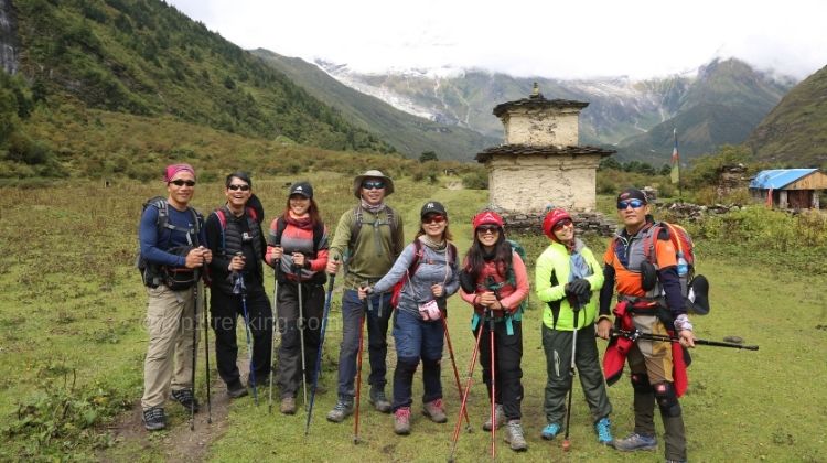
Manaslu Circuit Trek
Everything you need to know before trekking Nepal’s most underrated great circuit.
What Is the Manaslu Circuit Trek?
The Manaslu Circuit Trek is a 13- to 14-day teahouse trek that circles Mt. Manaslu (8,163 m), the world’s eighth-highest mountain. It starts at Machha Khola (around 890 m) in the Gorkha district, follows the Budi Gandaki River north through deep gorges and Tibetan-influenced villages, crosses the snowbound Larkya La Pass at 5,106 m, and exits into the Annapurna region at Besisahar.
Compared to Everest Base Camp and the Annapurna Circuit, Manaslu is quieter, more remote, and physically demanding. The trail was only opened to foreign trekkers in 1992 with a strict permit cap, and it still feels like a pioneering expedition. If you want to know what Himalayan trekking was like before the crowds arrived, this is it.
The trek passes through the Manaslu Conservation Area, home to Himalayan tahr, blue sheep, pika, marmots, and (rarely) snow leopards. Culturally, it traverses the lands of the Nubri and Tsum people – Tibetan-Buddhist communities with ancient monasteries, mani walls, and a way of life that has changed little in centuries.
Is This Trek Right for You?
Manaslu is ideal if you:
- Have already done Annapurna Circuit or Everest Base Camp and want something wilder
- Prefer remote trails with fewer trekkers over well-trodden routes
- Are comfortable with long walking days (6-9 hours) and steep ascents/descents
- Can handle basic teahouse accommodation and limited menu options at high altitude
- Are willing to hire a licensed guide and book through a registered agency (mandatory)
It is not ideal if you are a first-time high-altitude trekker, expect luxury lodges, or want to trek completely independently.
Trek Highlights
What makes this circuit worth the effort.
Larkya La Pass – 5,106 m
The highest point of the trek. A pre-dawn start, icy slopes, and a panorama of Manaslu, Himlung Himal, Cheo Himal, and Annapurna II. The descent to Bimthang is long and hard on the knees but surrounded by glaciers.
Ancient Monasteries
Pungyen Gompa (4,700 m), Ribung Monastery in Lho, and the Milarepa Caves reveal the deep Tibetan Buddhist roots of the Nubri and Tsum people. Most do not charge entry fees but run on donations.
Legendary Suspension Bridges
The bridges on this trek are among the longest and highest in Nepal. Some span dizzying gorges over the turquoise Budi Gandaki. The monsoon sometimes washes away smaller bridges, leaving semi-submerged rocks as the only crossing.
Tibetan-Style Villages
Sama Gaon (3,530 m) and Samdo (3,865 m) are the last major settlements before the pass. Stone houses, prayer wheels, yak pastures, and a culture that blends Nepalese and Tibetan traditions.
Wildlife
Himalayan tahr, blue sheep (bharal), pika, Himalayan marmots, and langurs are common. Snow leopards exist in the conservation area but sightings are extremely rare.
Manaslu Base Camp – 4,800 m
An optional acclimatization day hike from Sama Gaon via Birendra Lake (3,632 m). Standing at the foot of the world’s 8th highest peak is a powerful experience and the best preparation for Larkya La.
Altitude Profile
Understand your elevation gain day by day. Proper acclimatization is built into the standard itinerary.
13-Day Standard Itinerary
Kathmandu to Kathmandu. This is the most common pacing – adjust based on your fitness and acclimatization needs.
Arrival in Kathmandu – 1,400 m
Land at Tribhuvan International Airport. Most trekkers spend the night in Thamel for a final gear check and permit briefing. If you have not arranged permits yet, your agency will need your original passport and visa tomorrow morning.
Drive Kathmandu to Machha Khola – 890 m
Early start on the Prithvi Highway, then turn north toward Dhading. The road is paved to Arughat but becomes rough, dusty, and bumpy from there to Machha Khola. You will follow the Trisuli and Budi Gandaki rivers deep into the Gorkha district. Machha Khola is a small Gurung settlement on the banks of the Budi Gandaki – the trailhead.
Tip: A private jeep from Kathmandu to Machha Khola costs roughly $170-200 and cuts the journey to 6-7 hours. In early autumn, landslides sometimes block the road before Machha Khola, forcing trekkers to start from Soti Khola (730 m) instead.
Machha Khola to Jagat – 1,410 m
Walk upstream along the Budi Gandaki through subtropical forest. Langurs and monkeys are common in the canopy. Stop at Tatopani (Hot Water) for a natural hot spring soak if time allows. Cross several suspension bridges and navigate landslide zones before reaching Jagat – a stone-paved Gurung village and the official entry point to the Manaslu Conservation Area. Your permits are checked here.
Jagat to Deng – 1,804 m
Climb through Sirdibas and cross the river at Philim, where your permits are checked again. The trail enters a narrower gorge, weaving through bamboo and rhododendron forests. You will pass the turnoff to Tsum Valley on your right – a tempting side adventure if you have extra days. Deng is a small Tibetan-influenced village where prayer wheels turn and the culture shifts noticeably toward Buddhism.
Deng to Namrung – 2,630 m
The forest opens into a wider valley. Pass intricately carved mani walls and chortens as the landscape becomes more alpine. Namrung is a surprisingly lively village with some of the best teashops on the trek – one local entrepreneur even serves cappuccinos after a decade in Hong Kong.
Namrung to Lho Gham – 2,957 m
A shorter day with stunning views opening up. Lho Gham is dominated by Ribung Monastery and your first truly dramatic views of Mt. Manaslu rising above the ridgeline. The cultural shift is complete – you are now in Nubri territory, where Tibetan traditions, language, and architecture define daily life.
Lho Gham to Sama Gaon – 3,530 m
Trek through pine and juniper forests with Manaslu growing ever larger. Sama Gaon is the cultural and acclimatization heart of the trek – a sprawling village with ancient monasteries, yak pastures, and some of the most photogenic mountain backdrops in Nepal. You will spend two nights here.
Acclimatization Day – Manaslu Base Camp – 4,800 m
Do not skip this day. Hike to Manaslu Base Camp (4,800 m) via Birendra Lake (3,632 m), a glacial lake surrounded by snow peaks. The trail is steep and demanding, but standing at the foot of the world’s 8th highest mountain is a powerful experience. More importantly, this is your body’s best preparation for Larkya La.
Alternative: Visit Pungyen Gompa (4,700 m) for a shorter but equally rewarding day with panoramic mountain views. Pack a lunch, fill your water bottles, and bring warm layers.
Sama Gaon to Samdo – 3,865 m
A short, gradual day to the last village before the pass. Samdo sits just a few kilometers from the Tibetan border and has historically been a trading post. Explore Samdo Gompa, watch yak herders at work, and consider an afternoon hike to Samdo Ri for 360-degree views. The air is thin here – move slowly and hydrate.
Samdo to Dharmasala (Larkya Phedi) – 4,460 m
Cross an icy stream and enter a barren, high-altitude landscape. Dharmasala – also called Larkya Phedi (Base of Larkya) – is the final stop before the pass. Accommodation is basic (often dormitory-style), but the location is strategic. Rest all afternoon, organize your gear, and get to bed early. Tomorrow starts at 3 AM.
Dharmasala to Larkya La Pass to Bimthang – 3,590 m
The big day. Wake at 3 AM, headlamp on, and start the long climb in darkness. The trail is steep, rocky, and often icy – micro crampons are highly recommended for the descent. Reach Larkya La Pass (5,106 m) as the sun breaks over the Himalayas, illuminating prayer flags and a 360-degree panorama of Manaslu, Himlung Himal, Cheo Himal, Kang Guru, and Annapurna II.
The descent to Bimthang is long and hard on the knees, passing through glacial moraine and landslide zones. But Bimthang – Plain of Sand – is one of the most beautiful campsites in Nepal, a wide alpine meadow surrounded by towering peaks.
Bimthang to Tilje to Drive to Besisahar – 807 m
A gentle descent through rhododendron and pine forests, passing Gho village and crossing the Dudh Khola. The trail merges with the Annapurna Circuit at Dharapani before reaching Tilje. From Tilje, catch a shared jeep to Besisahar – the roadhead of the Annapurna Circuit. A hot shower and a proper bed await.
Note: In September, the road may not reach Tilje yet. You might need to trek an extra 2-3 hours to Dharapani to find a jeep.
Drive Besisahar to Kathmandu – 1,400 m
Drive back to Kathmandu along the Prithvi Highway. Arrive in the afternoon with time to explore Thamel or rest. Alternatively, you can drive to Pokhara from Besisahar if you want to extend your trip with lakeside relaxation and Annapurna views.
What Does It Cost?
These are typical costs you should budget for. Prices vary by season, agency, and your negotiation skills.
Permits (Mandatory)
| Permit | Season | Cost | Notes |
|---|---|---|---|
| RAP (Restricted Area) | Peak (Sep-Nov) | $100 / week | $15/day extra beyond 7 days |
| RAP | Off (Dec-Aug) | $75 / week | $10/day extra beyond 7 days |
| MCAP | Year-round | $30 | 1 passport photo needed |
| ACAP | Year-round | $30 | 1 passport photo needed |
| Tsum Nubri Entry | Year-round | NPR 1,000 | Paid at Jagat checkpoint |
Typical Trek Expenses
| Item | Typical Cost | Notes |
|---|---|---|
| Licensed guide | $30-55 / day | Mandatory. Includes their food, lodging, insurance |
| Porter | $20-25 / day | Carries up to 25 kg. Shared by 2 trekkers |
| Teahouse room | $0-10 / night | Often free if you eat at the lodge |
| Meals (B/L/D) | $25-40 / day | Prices rise with altitude. Dal bhat is cheapest |
| Private jeep (KTM to Machha) | $170-200 | Shared by 6-8 people. Bus is ~$10-15 |
| Shared jeep (Tilje to Besisahar) | $15-25 | Per person. Road-dependent in early autumn |
| Hot shower | $3-5 | Solar-heated, not always available above 3,500 m |
| WiFi / charging | $2-5 each | Slow and unreliable. Bring a power bank |
| Bottled water | $1-5 / liter | Price rises with altitude. Use purification tablets instead |
Budget Tip: Solo vs. Group
A solo trekker with a guide and no porter should budget roughly $1,200-1,600 for the full 13-day trek (permits, guide, accommodation, meals, transport). Two trekkers sharing a porter can reduce per-person costs to $900-1,300. Group discounts are common – a group of 4+ may negotiate guide rates down to $25-30/day. Always confirm exactly what your guide fee includes before booking.
Permits Explained
Four permits are mandatory. Here is how each one works and where to get it.
1. Restricted Area Permit (RAP)
The RAP is the big one. It covers the restricted zone from Jagat to Dharapani and is issued by the Department of Immigration in Anamnagar, Kathmandu. You cannot apply for this yourself – a registered trekking agency must submit your scanned passport, digital photo, and visa details online. The agency then deposits USD cash at the Global IME Bank counter inside the immigration office (they literally list every note’s serial number). The Director General reviews and signs the permit, which takes about 1.5-2 hours on a normal day. Not available on Saturdays or public holidays.
2. Manaslu Conservation Area Permit (MCAP)
Issued by the Nepal Tourism Board (NTNC) in Kathmandu or Pokhara. Covers the area from Philim onwards. Requires one printed passport photo. Costs $30 year-round.
3. Annapurna Conservation Area Permit (ACAP)
Also issued by NTNC. Required because the trek exits into the Annapurna region at Dharapani. Costs $30 year-round. One printed passport photo needed.
4. Tsum Nubri Rural Municipality Entry Fee
A newer fee (introduced in 2025) paid locally at the Jagat checkpoint. Costs NPR 1,000 per person. No photo required.
Where Your Permits Get Checked
- Jagat – First RAP checkpoint entering the restricted zone
- Philim – MCAP checkpoint
- Samagaun – Last RAP checkpoint before crossing into ACAP zone
- Dharapani – ACAP checkpoint exiting into the Annapurna region
Keep your permits in your daypack at all times. Checkpoint officers on Manaslu are thorough – more so than on Annapurna or EBC routes.
Do You Need a TIMS Card?
No. TIMS is not required for the standard Manaslu Circuit. The RAP serves as your restricted-area registration. You only need TIMS if you extend your trek onto the full Annapurna Circuit from Dharapani.
Frequently Asked Questions
Real questions from trekkers, answered from the trail.
It is rated moderate to challenging. The trail itself is not technical, but the long days (6-9 hours of walking), steep ascents and descents, and high altitude make it demanding. The pass crossing day is 8-10 hours total. Good cardiovascular fitness and prior trekking experience are highly recommended. You do not need to be an athlete, but you should be comfortable walking uphill with a daypack for multiple consecutive days. If you have done Annapurna Circuit or Everest Base Camp, you have the right baseline.
Spring (March-May) and Autumn (September-November) are ideal. April and October are the absolute best months – stable weather, clear skies, and moderate temperatures. Spring brings blooming rhododendrons; autumn offers the crispest mountain views. Winter (December-February) is possible but Larkya La may be snowed in and teahouses above Samdo sometimes close. Monsoon (June-August) is not recommended due to landslides, leeches, and washed-out bridges.
As of 2026, solo trekkers are allowed in the Manaslu restricted area, but you must be accompanied by a Nepal Government-licensed trekking guide and book through a registered agency. You cannot obtain the Restricted Area Permit independently. The previous two-person minimum has been removed, so you no longer need to find a trekking partner. However, going with a guide is mandatory for safety and permit reasons. Freelance guides without agency registration cannot process your permits.
Highly recommended. A porter carries up to 25 kg and costs roughly $20-25 per day. Two trekkers typically share one porter. Without a porter, you will carry 8-12 kg yourself on long, steep days at high altitude – which significantly increases fatigue and altitude sickness risk. If your budget allows, hire one. It is also a direct way to support the local economy.
The standard itinerary includes a dedicated acclimatization day at Sama Gaon (Day 8) with a hike to Manaslu Base Camp (4,800 m). Key rules: ascend slowly (no more than 500 m sleeping altitude gain per day), drink 3-4 liters of water daily, avoid alcohol, and eat carbohydrate-rich foods. Consider Diamox (acetazolamide) as a preventive – start 1-2 days before ascending above 3,000 m. Know the symptoms: headache, nausea, dizziness, shortness of breath. If symptoms worsen, descend immediately. Do not push through it.
Essentials: layered clothing (base layer, fleece, down jacket), waterproof jacket and pants, trekking boots (broken in!), micro crampons for the pass, trekking poles, sleeping bag rated to -10 degrees C, headlamp, sun hat, warm hat, gloves (liner + insulated), sunglasses (UV400), sunscreen (SPF 50+), water purification tablets, and a first aid kit. Most agencies provide a down jacket and sleeping bag on loan if you do not have your own. A 40-50L daypack is sufficient if you hire a porter for your main bag.
Teahouses serve a mix of Nepali, Tibetan, Indian, and basic Continental dishes. Dal Bhat (rice, lentil soup, vegetables, pickles) is the staple – it is nutritious, filling, and often comes with unlimited refills. Other options include momos, noodles, pasta, pancakes, porridge, and Tibetan bread. Prices rise with altitude (a plate of dal bhat might be $4 at Machha Khola and $8 at Dharmasala). Meat is available at lower elevations but becomes scarce and less fresh higher up. Vegetarian meals are widely available and often safer.
Ncell and Nepal Telecom have coverage along most of the trail, but signal is weak and unreliable in remote sections. Most teahouses offer WiFi for a small fee ($2-5), but speeds are slow and intermittent – good enough for messages, not video calls. Do not plan to work remotely. Carry a power bank; electricity is available in the evenings at most lodges but may be solar-dependent at higher villages. Charging your devices can cost $2-5 per hour.
Yes, and it is highly recommended if you have 4-5 extra days. Tsum Valley is a hidden Tibetan-Buddhist valley north of the main Manaslu trail, home to the ancient Mu Gompa (3,700 m) and Chumling village. The Tsum Valley requires a separate permit: $40/week in peak season or $30/week in off-season, plus $7/day for extra days. You branch off at Philim, explore the valley, and rejoin the main circuit at Deng or Namrung. The combined trek is 17-18 days total and is one of the most culturally rich experiences in Nepal.